


The site will serve both Australia and New Zealand and aims to eventually improve the accuracy of GPS signals to as little as 10 centimetres.
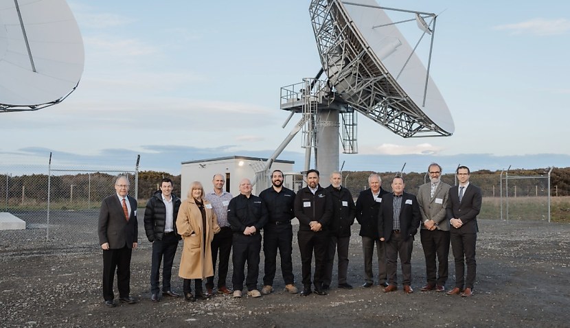
Located on the southern tip of the South Island, it was opened by the country’s Minister for Land Information, Chris Penk, alongside representatives from Av-Comm, who are physically installing the apparatus.
“Strategically located in Awarua to leverage Southland’s favourable geographic position for optimal satellite communication and coverage, the facility boasts two 11-metre satellite dishes and a control centre with dual radio frequency uplinks,” said Lockheed Martin.
“This capability benefits agriculture, aviation, construction, consumer, resource, road, rail, maritime, mining, utilities, and more.”
The $1.18 billion project is a collaboration between Geoscience Australia and Toitū Te Whenua Land Information New Zealand, alongside NSW-based Av-Comm and Lockheed.
“As the project develops, one of the most noticeable changes for the public will be less disruption to flights during bad weather, with a significant reduction in weather-related flight cancellations and delays,” said Minister Penk.
“SouthPAN services will aid flight navigation, making it safer for planes to land when visibility is poor.”
PROMOTED CONTENT
“Improved GPS accuracy has far-reaching benefits for the economy with implications for almost every major sector, from agriculture to aviation, forestry, and construction.”
SouthPAN works by using a number of distributed ground stations to monitor signals broadcast by Global Navigation Satellite System (GNSS) satellites. It then compares each station’s known location with position data from the satellites.
“The GNSS signal data and measurement information is sent to correction processing facilities,” Geoscience Australia said.
“The facilities aggregate the data from all ground stations, produce error corrections and status information about the GNSS satellites, and format the data in a standardised series of messages.
“These messages are sent to an uplink station, which transmits data to a satellite in geostationary Earth orbit. The data is broadcast to all precise positioning users, who combine SouthPAN’s data with their own observations of GNSS satellites.”
The news comes after Space Connect reported how Lockheed successfully installed the first SouthPAN satellite dish in December 2023 in Uralla, NSW.

Adam Thorn
Adam is a journalist who has worked for more than 40 prestigious media brands in the UK and Australia. Since 2005, his varied career has included stints as a reporter, copy editor, feature writer and editor for publications as diverse as Fleet Street newspaper The Sunday Times, fashion bible Jones, media and marketing website Mumbrella as well as lifestyle magazines such as GQ, Woman’s Weekly, Men’s Health and Loaded. He joined Momentum Media in early 2020 and currently writes for Australian Aviation and World of Aviation.
Receive the latest developments and updates on Australia’s space industry direct to your inbox. Subscribe today to Space Connect here.


